3D Laser Mapping
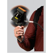
GeoSLAM was founded in 2012 and is a joint venture between CSIRO and 3D Laser Mapping.
Role of the modern surveyor is rapidly changing as demands grow to quickly and accurately capture, manage and utilise 3D spatial information. Many surveyors need to work in hazardous environments (such as live construction sites or in buildings being renovated), as well as in complex and difficult to access spaces where there is limited or no GPS coverage (such as heritage buildings with thick stone walls). And they will often have a very limited time on site to accurately create a 3D model. Access to user friendly technology that can quickly scan multi-level environments and produce accurate and high quality 3D survey data can be a game-changer for surveyors.
System Features:
- Highly Portable
- IP-64
- No need of GPS
- Works on SLAM Algorithm
Benefits of GeoSLAM:
- Rapid scanning with time
- "Go anywhere" mobile mapping
- Saves time and money
- Proven technology
- User Friendly Software
Industries:
- Buildings
- Forestry
- Mining-Underground and stockpile
- Marine
- Security


